London 2024
- Walking With Brian
- Jul 22, 2024
- 35 min read
Updated: Sep 16, 2024
The summer walking trip to London is now an annual pilgrimage for me. This year I booked four nights at the Walrus Hostel in Waterloo, where I had stayed on my first visit. The location is ideal for tube and rail connections and the facilities - although spartan - are more than adequate. I simply need a place to get my head down for the night and the ability to rustle up food in the small kitchen helps keep costs down. The plan for this year was to bookend my Thames Path progress with two further legs and also make inroads to the city's canal network. On my final day, the train back home was scheduled to depart at 4pm and this would afford me ample time to explore the central London parks. Museums would feature on my itinerary as always, but I ensured the schedule would not be an overly hectic one. It is nice to have some time to unwind during the day. It's a holiday after all.

My train journey south had a key difference this year. I was booked to travel on the West Coast Main Line. I had spotted a cheap ticket offer from Glasgow and I began my trip on the direct Stagecoach bus from Cairneyhill. It was a warm day in the city centre and I had lunch on the steps of the Royal Concert Hall. A hardcore Christian preacher was spouting his message on the corner but failed to attract much interest, until one man stepped forward to listen, only to be told his claim of never having sinned is itself the sin of self righteousness. A real barrel of laughs this sermon! I had plenty time on my hands and whiled away an hour at Central Station reading about the escapades of Felix the railway cat from Huddersfield. Felix sadly passed away last year and has been succeeded by her kitten apprentice Bolt, who now performs pest control duties around the grand Yorkshire transport hub. Soon it was time for me to board. I had a seat booking and the space next to me, although also reserved, remained unoccupied for the entire journey, giving me plenty of room to spread out. After clearing the Lanarkshire conurbation, it struck me that the southwest of Scotland is largely uninhabited. Endless fields of cattle and sheep. In Dumfriesshire, the railway parallels the M74 for long stretches and a procession of lorries travelled up and down. The English stops were Carlisle, Oxenholme, Lancaster, Preston, Wigan and Warrington. The service ran more or less to schedule and rolled into London Euston just after 7pm. Large parts of the station's footprint are fenced off due to paused HS2 construction works. Not only has the high speed link lost its northern legs, but it is now uncertain whether services will ever reach the heart of London. Private investment is required and the new government has kept quiet on the matter so far. It would be a sad state of affairs if such a grand scheme were to terminate on the edge of the city. I had planned to walk the two and a half miles to the hostel, pausing for a bite to eat in Trafalgar Square. However the rain came on hard as I hit the main road, sending me scuttling back into Euston to catch a tube to Waterloo. After devouring a sandwich on the station concourse, I jogged round to my accommodation, relieved that I had avoided a serious soaking on my first night. I already had the security code for the front door and was soon in my dormitory. I had a bottom bunk this year. Perfect. The plan for my first full day was to walk the entire Regent's Canal from Paddington Basin to Limehouse by the Thames. Eight and a half miles long. Lambeth North underground station was just along the road from my digs and provided a direct link to Paddington, the second busiest station in the UK, dating from 1854. I worked my way round to the canal basin and immediately spotted a couple of Egyptian geese. Introduced to Britain as ornamental birds, they escaped into the wild and now breed successfully across the London watercourses.

The towpath led to a bustling junction called Little Venice. The Regent's Canal splits here from the Paddington Arm of the Grand Union Canal (which ultimately goes all the way to Birmingham). The Regent's corridor opened fully for business in 1820 and linked the London docklands to the inland waterway network and the industrial heartlands further north. Wide cargo barges were pulled by horse until the 1950s, when mini tractors were introduced. It should be noted that a barge has no motive power of its own. The vessels you see chugging up and down British canals today are narrowboats. Commercial traffic along the Regent's Canal had all but vanished by the end of the 60s and today the waterway is used extensively for leisure and serves as an urban wildlife strip. The towpath now throngs with walkers and cyclists. There are many Londoners who live in narrowboats. Mooring rates vary according to location and the facilities provided. I noticed several craft taking fresh water on board from taps on the bank. There is also the budget option of buying a licence to continually cruise, taking advantage of free spots where you are permitted to stay up to 14 days before moving on. This may work quite well in the summer but must be a harsh way of life at other times of year, particularly as you may find yourself in less salubrious parts of the city some way from vital amenities. The first few hundred yards of the Regent's walk was along a pavement as the mooring strip was private property. An electric bin lorry cruised the street. I joined the towpath alongside more tied-up boats and the residents had created their own little garden areas. It wasn't long until I reached an open stretch of canal. There were some spectacular mansions across the water to my right, including Winfield House, official residence of the United States ambassador to the UK. On the towpath, a high metal fence rose to my left. Leafy gardens contained signage warning that guard dogs were on patrol. Clearly a statement directed at the passing hoi polloi. The canal runs around the northern fringe of Regent's Park and the two facilities opened around the same time. London Zoo occupies a chunk of the green space and I could see visitors wandering around the enclosures on the opposite side. Steel walkways passed overhead taking zoo customers to Monkey Valley on the northern side of the canal. Once clear of the animal territory, I was able to climb up to street level and enter the public area of Regent's Park. I headed down the Broadwalk towards the world-famous rose garden. Covering 410 acres, the park contains London's largest outdoor sports area. The boundaries are home to 120 species of birds and many tree varieties, as well as housing the city's only breeding population of hedgehogs. There are wild meadows, historic grasslands and even an outdoor theatre. I passed the elaborate Readymoney drinking fountain (unfortunately turned off) and passed into Queen Mary's Garden - named after the wife of King George V and grandmother of Queen Elizabeth II. The floral enclosure opened to the general public in 1932 and 12,000 roses are planted here. There are 85 single-variety beds on display and most rose varieties, from classics to the most modern English styles are present. I paused on a bench for a moment of quiet contemplation.

Back on the towpath, I walked by a floating Chinese restaurant before reading about a major explosion in 1874 that destroyed one of the bridges leading out from the park and across the canal. A barge named Tilbury was third in a train of vessels being towed by a steam tug westwards. It was laden with sugar, nuts, a few barrels of petroleum and five tons of gunpowder. The latter substance caught fire, causing a huge bang just as the barge passed under the Macclesfield Bridge. The crew was killed instantly, the bridge collapsed and windows shattered up to a mile away. The blast severely damaged the nearby house belonging to painter Lawrence Alma-Tadema, who was fortunately away at the time. The explosion caused widespread havoc and a detachment of Horse Guards was summoned to help keep order and to ensure safety from wild animals at the Zoo. The canal was out of action for five days and the bridge was ultimately rebuilt in 1876 using the original iron columns. The next point of interest on my walk was Camden Lock. A temporary Sunday market was established here in 1974, occupying outdoor areas by the canal and a few existing buildings. A controversial urban motorway proposal was expected to cut through the site but plans were dropped in 1976, by which time the market was a firmly-established attraction. Only 16 traders attended the first staging but growth was swift and today the market complex is open daily and attracts a staggering quarter of a million visitors per week. The area was heaving as I arrived and I had to jostle my way through the throngs of people at the hot food stands. I wandered around an indoor space where music merchandise and alternative clothing was on sale. Tunes pumped out constantly. I would absolutely have loved this environment 30 years ago! Still interesting today. There was a good second-hand bookshop too! Many people were milling about by the canal side as I continued my trek. I passed below several sets of railway tracks emanating from St Pancras Station before reaching the canal basin of the same name. King's Cross Station is practically next door but departing trains disappear into tunnels. Major London rail termini are often grouped closely together, as private operators were allowed to construct their tracks up to the edge of the central business district, but proceed no further. This is the main reason why the tube network expanded so rapidly across the heart of the city once suitable excavation methods became available. A massive transformation has taken place behind the two large stations in recent years. Acres of derelict industrial land has been given a new lease of life by creating leisure, retail and residential facilities, with the canal running through the heart of this regenerated public space. I passed by Gasholder Park, an oasis of green within the towering wrought iron frame of a former energy storage facility. Another two have been incorporated into the construction of circular apartment blocks. King's Cross once had a dozen of these massive tanks, built from 1860 to 1880. Gasholders were used a buffer supply and held sufficient fuel reserves to cope with peak demand periods. The cylinder within the frame rose and fell in accordance with the levels of gas on hand, which was produced locally by extraction from coal. With the discovery of North Sea natural gas in the late 60s, town gasworks became a thing of the past but many of the old holding tanks were absorbed into the national grid. The Victorian structures finally became redundant as the 21st century arrived. Technology advances enabled high-pressure pipework to store enough spare capacity underground. Some gasholders were demolished, others converted to monuments or simply left to rust. Nowadays the area behind King's Cross and St Pancras stations is home to a vibrant community with reminders of the heavy industrial past.

Granary Square has been created upon the site of a former loading depot. Artistic fountains squirt from the ground and the artificially-turfed green terrace is a popular place to sit. The station is just a few hundred metres away but I wonder how many of the people arriving know of this calm oasis just a short walk from the platforms. My next port of call was the London Canal Museum, located on Battlebridge Basin. There is no direct access from the towpath and I had to use the adjacent streets to reach the entrance. Opened in 1992, the museum is housed within a Victorian building that functioned as an ice warehouse. In the days before electric refrigeration, ice was shipped in from Scandinavia and stored in two subterranean wells. In the 1920s, the premises became a horse & cart depot. Various firms used the site for storage and light engineering purposes until modifications took place in 1956. The stables were stripped out and the ice wells filled in. The building was now in the hands of an Italian food importer. After a period of disuse, the museum trust took over the reins in 1989 and the result is an informative visitor attraction, well worth the £7.50 admission charge. The basic canal concept dates back to Roman times, when primitive channels were dug to connect one river to another one nearby. The invention of locks in 1500s was a great leap forward and allowed lengthy waterways to become a practical proposal. By 1790, the Rivers Trent, Mersey, Severn and Thames were joined by a series of canals and goods could be moved from one to the other without having to make long journeys around the coast. These early successes prompted a flood of constructions schemes, not all of which were financially viable. The ground-floor museum displays included a Regent's Canal tractor. It was also possible to look down into the ice well that had been partially excavated. The original depth was 10 metres and a bit less than half of this has been unearthed. A handy cutaway model showed how the storage process worked. I learned that boatmen originally lived ashore but took up cost-cutting residence in their vessels due to competition from the railways. A door connected the first-floor of the museum to the edge of Battlebridge Basin and I ventured outside for a look around. Plenty boats were moored, all pleasure craft I assume. Yet an aerial photo from 1921 depicted an emptier scene. The waterway network was already in decline, although it hung on nationally for another thirty years or so. The mass production of lorries and continuing road improvements enabled a "door to door" service that canals could not match. The industry was nationalised in 1947 but the writing was on the wall. The final nail in the coffin came after the harsh winter of 1963. The "big freeze" prevented boats from moving and many lost their remaining trade.

The Transport Act of 1968 categorised canals into three groups: Commercial Waterways (a few), Cruiseways (for leisure) and Remainder Waterways, to be left to their fate, which in many cases was abandonment or even disposal. Gradually a programme of re-openings and refurbishments gathered pace and by the turn of the century, many routes across the country were promoted as vital wildlife corridors, offering opportunities for walking and cycling. Canals are now firmly back on the map. Industrial developments often involve multiple strands. The ability to bring large quantities of coal into central London by canal enabled the rapid expansion of gas lighting. Indeed, the St Pancras gasworks were the largest in Europe. The coming of electricity required many local power stations to be built in the days before a national grid existed. Six were established along the banks of the Regent's Canal. In the long term, the railway played a major role in the canal's demise but initially the two systems happily co-existed. Marshalling yards abutted wharves to enable the smooth transfer of freight. Lock keepers were once an essential link in the commercial traffic chain but far fewer are employed today. Leisure transport can happily proceed at a slower pace and only the very busiest locks today are manned. People often forget that canals require an active water supply (and have to be filled in the first place). This is an important part of the engineering process and the best source is a stream or river running at a higher level. This supply cab be captured in a reservoir if required. The option of forcibly pumping water into the canal system is always far more expensive. Many food factories were set up alongside the new London canals, helping to feed the ever-growing population. There were an estimated 300,000 working horses in the capital by late Victorian times. They too had to be nourished, not the mention the huge task of dung removal. I enjoyed my wander around the museum and it was time to press on and grab some lunch. As I approached the 960-yard Islington Tunnel, I had to step away from the waterside as the towpath runs out here. Boatmen originally had to "leg it" through the gloom, i.e. physically propel the craft by placing their feet against the stone walls. A steam tug was introduced in 1826, changed to diesel in the 1930s. Nowadays, narrowboats simply sail under their own power.

I criss-crossed the streets above and headed into Chapel Market, in search of a bite to eat. Officially recognised as a street market in 1879, Chapel is a no-frills affair with stalls selling fruit, vegetables, clothing and various household goods. The shops lining either side of the street are mostly independent traders and I picked up a couple of large oranges from a fruit outlet and a roast beef baguette at Wenzel's Bakery - who have a number of shops in the southeast of England. Suitably victualled, I strolled down to the Angel tube station. No, I wasn't skipping part of the canal trail, but making a detour to visit the Bank of England Museum, a mile and a half distant. Alighting at Bank (where else?), I got my bearings and walked along Threadneedle Street in the traditional City of London - the heart of the UK's financial industry. Colloquially known as the square mile (it's actually 1.12, not far off), "The City" is not one of the 32 London boroughs, instead having its own special administrative status. It's roots lie in the walled settlement called Londonium, founded by the Romans in AD43. The impressive Bank of England building contains a museum which is free to enter. Security was tight and all bags were being scanned. The cool galleries were a welcome break from the oppressive heat outside and I had a seat before looking around. Under the supervision of architect Sir John Soane from 1788, the bank premises were extended to cover the whole of the present site. Rebuilding in 1925 saw the addition of extra storeys and an enlargement of the museum took place in the 1980s, at which point general public admission was offered rather than by appointment only. The institution was founded in 1694, after the installation of William & Mary as joint sovereigns fundamentally changed the relationship between Parliament and the Crown. Scotsman William Paterson was instrumental in setting up the national bank. The business moved to Threadneedle Street in 1734 and the first fixed denomination banknotes followed in 1743. Slave sugar plantations were owned as an asset, not an unusual investment at the time, but one that is rightly addressed nowadays within the context of the exhibitions. The government paid huge amounts of compensation to slave owners after abolition. Those directly affected received precisely nothing. The gallery displays were by no means confined to the financial events of past centuries. My favourite part of the museum was the modern look at currency, which of course involves a diminishing use of cash. Text panels presented the information in relatable terms and I highly recommend a browse.

Cash was already in decline as we progressed through the first two decades of the 21st century, but still accounted for more than half of all British payments in 2011. This dropped rapidly to just 15% during the pandemic and the figure stood at 14% in 2022, when restrictions had finally vanished. 70 million debit and credit card transactions are made in the UK every day. People now routinely zap money to friends and family via banking apps or third-party operators such as PayPal. Just think about the last time you went out for a meal with a group of people. A decade ago it was normal practice to throw cash on the table at settling-up time. Nowadays individual shares are often paid by card on the premises, or one person agrees to front the lot, then recoup from the other diners electronically. From the perspective of the business, handling less cash reduces the theft risk and can involve less trips to a physical bank, but means taking processing fees on the chin (or you could just pass them on to the customer). The concept of cryptocurrency was examined. They exist only online and - crucially - are not backed by a government. Basically, crypto functions outside the mainstream banking and is deemed risky because the value can shoot up and down very quickly. Maybe worth a small punt, but don't chuck all your eggs in this particular basket. Rather than ignoring this financial "Wild West", central banks and governments around the world are actively studying the mechanisms of cryptocurrencies. The likelihood is that regular money will become increasingly digitalised. Smartphones didn't exist 20 years ago. Who knows which road we will travel down in the future. The First World War had a huge impact on international trade systems. The Bank of England became a central bank during this time, remaining a private institution but no longer engaging in competition. Instead, it concentrated exclusively on its public responsibilities. No contingency plans existed for the global conflict and the financial cost was astronomical. By contrast, the outbreak of WW2 came as much less of a surprise and the bank had a reserve of measures to put in place. Emergency banknotes with new colours and designs were released to combat the threat of credible forgeries from overseas. An influx of fakes could have caused confusion in the economy. Nationalisation became a reality in 1946 with the election of a post-war Labour government. The bank adapted and moved into the new era. I browsed the information about forgery with interest. Replicating the feel of money is one of the biggest challenges. My mum ran a post office for years and it was often possible to identify a dodgy banknote purely by touch. One of the most pertinent questions posed ran as thus: Why are we still printing money? Some surprising facts were revealed.

Five out of six payments are now electronic but there is actually MORE cash in circulation than at the start of the pandemic in 2020. This may be due to many people building up stockpiles at home. I was glad I'd taken the time to nip down to the museum and there was an added bonus - it had been raining while I was inside and, although it was still wet as I scuttled back to the tube station, all was fair as I arrived back at Angel to continue my canal wander. After picking up a welcome bottle of Irn Bru and getting my street bearings, I re-joined the towpath at the other end of Islington Tunnel and continued along my merry way. Edging away from the centre of London, the canal took on a less salubrious feel and wound its way through mixed terrain. I concentrated on clocking up the remaining miles, although I took a break as I skirted Victoria Park - the capital city's oldest public green space, opened in 1845. Situated within the modern administrative borough of Tower Hamlets, the park isn't too far from the Olympic facilities created at Stratford for the highly-successful 2012 games. I passed the junction with the one-mile Hertford Union Canal, which links to the navigable River Lea, a major tributary of the Thames. A network of trails connect the Olympic sites and the Lea itself has a lengthy footpath alongside. I think I'll be chipping away at these London watercourses for some years to come! Eventually I arrived at Limehouse Basin by the Thames. My mission for today was at an end. Once used to trans-ship goods between the Port of London and the English canal system, the basin lost its commercial traffic at the end of the 1960s and fell into dereliction. Redevelopment commenced in tandem with the cleaning up of the old docklands and Limehouse now thrives as a leisure hub. The DLR (Docklands Light Railway) runs close by and has been operational since the late 80s. Speaking of which, I saw the London Transport logo a short walk away and headed towards the station as I had done enough walking for the day. I switched to the underground at Bank and was soon back at the hostel. The daily fare cap for zones 1/2 is a bargain £8.50. I was in no mood to cook and a large tub of soup from Sainsbury's helped wash down some chicken pieces. After a soothing shower, I stretched out on my bunk and rested in preparation for round two the following day.
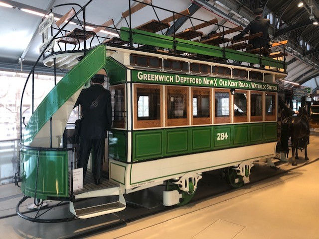
First on the agenda was my first ever visit to the London Transport Museum, located at Covent Garden, a few steps from the Strand. I walked over Waterloo Bridge and bought a takeaway breakfast roll at the Crown Café, a cheap and cheerful pit-stop in the heart of London. I arrived at the museum half an hour before opening and filled in the time with a wander around the Covent Garden streets. The Royal Opera House is situated here, along with several theatres. Until 1974, Covent Garden was home to the famous fruit, vegetable and flower market (open every day except Christmas), which now trades at Battersea. Traffic congestion was responsible for the relocation and the Museum of Transport took over the premises, opening for business in 1980. Next door is the Jubilee Market Hall which sells all manner of souvenirs and other items. I entered the museum at 10am and flashed my annual pass, which I'd bought online for £24.50. This entitles you to book as many entry slots as you like within a 12-month period. Of course, I'd only be using it once. There is no option for a one-off ticket. In similar fashion to the London Docklands Museum, you proceed straight to the top floor and work your way downwards through time. The first displays dealt with early river transportation and the coming of the railways. London was already the world's biggest city and busiest port by 1800. The tidal Thames was the driver of this growth but also acted as a barrier to internal movements. For centuries, London Bridge was the only crossing point and by 1769, just two more (Westminster and Blackfriars) had been added. Licensed watermen provided taxi and ferry services in small rowing boats and competition for trade was fierce. Steamboats arrived in 1815, coming up the Thames from estuary ports such as Gravesend and carrying both day-trippers and commuters. The river was more crowded than ever and accidents were common. In 1878, a coal ship struck the Greenock-built paddle steamer Princess Alice and around 650 people died. The first passenger railway ran from London Bridge to Greenwich and quickly proved successful. Opened in 1833, was transporting over two million people annually by the turn of the next decade. Railway mania was growing but parliament moved swiftly to outlaw the building of lines through the heart of London. This is why the fringe of the city centre today is ringed by several termini. Fifteen road and foot bridges across the Thames were constructed during the 19th century. The vehicle ferry at Woolwich was classed as a moving bridge and remains free to use today. Early experiments with trams powered by gas, steam and batteries proved unsuccessful and horse-drawn services still dominated street transport in 1900. Pulling carriages on smooth iron rails was an effective method of moving people around. Horse buses were slower and offered poorer ride quality. Internal combustion engines were still primitive and unreliable at this time. The first underground railway opened in 1863 but can't have been a pleasant experience as the tunnels were filled with smoke from the steam locomotives. Nevertheless, the system began to expand and early routes were built using a technique called cut and cover. A trench was excavated, tracks were laid and the roof restored. The deep tube tunnels and electric power became a reality in the 1890s.

It was enjoyable exploring the exhibits and sitting in the old underground carriages and horse-drawn omnibus. The ground floor covered the era of motorised road transport and several London buses were on display. Increasing car ownership led to high levels of congestion and bus services were caught up in the chaos - an issue still pertinent today. Drivers of the traditional black taxis have to pass a complex geography test termed the Knowledge before gaining a licence to operate in this heavily regulated trade. Minicabs were introduced in the 1960s but they are not allowed to ply for trade on the streets and can accept only pre-booked fares. London, like all other UK cities expect Blackpool, lost its tram network in the post-war period. A handful of places have recently restored urban light-rail and London now has trams running from Croydon to Wimbledon. The city also had trolleybuses between 1931 and 1962. They were introduced as replacement vehicles on a number of tram routes, being more comfortable and capacious than the rickety old street cars. Power was drawn through a pole on the bus roof. Around 70% of the system was converted to the new virtually silent method of running and at one time London boasted the largest trolleybus fleet in the world. Plans changed after the war and diesel buses were seen as the way forward. They could drive on any road and there was no need to maintain overhead electrical equipment. On the river, the city council abandoned public steamboat services in 1908 and the Thames became the domain of leisure cruises. However, the 21st century has seen the emergence of London River Services - a subsidiary of Transport for London (TfL) serving 24 piers between Putney and Barking. The museum also featured displays on the role played by women and Caribbean immigrants on the London transport network over the decades. After a very informative couple of hours, I left the museum and walked a mile and a half to Cannon Street Station in the City of London, passing St Paul's Cathedral on the way. My route took me along Fleet Street, until fairly recently a major hub for the newspaper industry. With the advent of computerised printing in the mid-80s, the big titles began moving to new locations. The façade of the DC Thomson building is prominently inscribed with the names of popular Scottish publications the Sunday Post, Dundee Evening Telegraph and the People's Friend. Although the company still owns the building, the last working journalists on Fleet Street vacated the premises in 2016. At Cannon Street, I boarded a train for Woolwich, immediately crossing the river. Today I wanted to continue my downstream Thames Path progress to Erith, a walk of around seven miles. I needed lunch before setting out and Woolwich town centre just happens to have one of the remaining Wimpy restaurants. The burger chain currently has 62 British outlets (three in Scotland), down from almost 400 in the late 80s. I remember Wimpy well from my childhood and ate there before I had even heard of McDonald's. Last year I had hoped to dine at the Teddington Wimpy on my Thames wanderings, only to find the restaurant had recently closed.

This time around, I wasn't missing my chance. Wimpy offers table service and there was a Wednesday special deal on offer. Burger, fries and a drink for £8.50. I ordered a side portion of onion rings to bring my bill up to a round tenner. I watched the world go by outside while savouring the food. Afterwards, I popped over the road to Wetherspoons for a pre-walk pint before heading down to the river. Woolwich had a strong military presence for centuries, finally winding down in the 1990s. Part of the old Royal Arsenal site has been redeveloped for mixed residential and commercial use. I wrote about this topic in last year's London blog. I passed through a heritage area with the curious Assembly sculpture - a cluster of 16 steel men made from partial body moulds bolted together - reflecting the idea of mass production. The path from Woolwich to Erith tracks the riverside all the way and the landscape becomes increasingly dominated by large industrial plants as the urban density of Greater London thins out. This is all part of the river's story and I regard all aspects of the exploration as equally valid. The navigation signs now featured a barge symbol, rather than the acorn that denotes official national walking trails. Perhaps the ratification of these government approved routes requires special legislation. The acorn-badged route ends at the flood barrier, a mile upstream from Woolwich. I was now on the Thames Path extension but in reality it's all part of the same experience. The width of the water had now increased and I sensed the beginnings of the estuary. Walking along the flat tarmac path was straightforward enough but the sun was beating down in a stamina-sapping manner. There were plenty of ripe brambles to munch on and few birds flitted by. The route skirts the town of Thamesmead and a banner advertising a local music festival had been attached to a fence. An information panel told me that this section of pathway opened in 2000, providing public access to the river bank for the first time in over 150 years. I soon approached a goal for all urban explorers - the Victorian sewage works! The Grade-1 listed building dates from 1865 and was designed by Sir Joseph Bazalgette - a famed civil engineer who devised a sewerage system for central London, finally ridding the city of cholera epidemics and relieving the stink and serious pollution that arose from simply channelling raw human waste into the Thames. The Crossness Pumping Station features the world's largest rotative beam engine in the world. Powered by steam, it raised the incoming piped sewage into a holding reservoir, from where it was then discharged into the Thames estuary on an outgoing tide. While certainly a massive improvement, the fact remained that the city's sewage disposal problem had merely been moved upstream. The Princess Alice maritime disaster occurred as waste was being released from nearby Crossness, causing many people to perish from the effects of ingesting toxic water. A better solution had to be found. Sedimentation tanks were added in 1891 to store separated sludge, which was loaded on to boats and dumped far out at sea. Not a job I would fancy! Surprisingly, this arrangement continued until 1998. Nowadays the solid matter is incinerated and electricity produced via this process.

The original brick pumping station had been decommissioned in the 1950s and replaced by a more modern facility built alongside, that allowed the sewage effluent to be more effectively treated. It was decided not to dismantle the steam engines as the cost of doing so far exceeded the scrap value. Instead, easy pickings such as brass components were removed and the site was left to decay. In 1988, the Crossness Engines Trust was formally registered as a charity and restoration work has taken place over the years, greatly aided by grants from the Lottery Heritage Fund. A couple of open days are staged each month and the venue is also available for private hire. Photos on the trust's website reveal stunning interior architecture - a veritable cathedral of iron. A nature reserve adjoins the old industrial site and is home to Britain's rarest bumble bee, the shrill carder. The land is also a stronghold for the rare and declining water vole. Out on the Thames, a twice-daily tide drop of six metres exposes mudflats rich in shellfish and worms, providing vital nutrition for a number of bird species. The air was rather whiffy as I passed the modern sewage plant, but nothing too offensive. The final stretch to Erith hugged the contours of the Thames and a concrete wall and spiky security fencing on my right screened a large industrial estate. Eventually I reached the town and was looking forward to resting in the Riverside Gardens, but unfortunately they had been completely dug up as part of a major renovation project. Maybe next year! Clocking the British Rail logo across the road, I decided I'd done enough of the Thames Path for the day and I sauntered over to catch a train to London Bridge. On the journey, I spotted The Den - home of Millwall FC - and I arrived at a heaving terminus. Opened way back in 1836, London Bridge is the fourth-busiest railway station in London, handling over 50 million passengers each year. It was completely remodelled between 2009 and 2017, as part of the Thameslink Programme, a £6 billion project that facilitated new north-south London connections, lessening the need to change trains within the city. Getting my bearings, I located the exit and I walked a couple of miles along the bustling south bank of the river, towards Waterloo. Various street performers were doing their thing and I paused outside the Tate Modern Gallery to phone my mum, updating her of my progress so far. Back at the hostel I followed the now-established routine of dinner, shower and bed. Tomorrow would be a day dedicated entirely to walking. No museums to traipse around! The schedule was a 12-mile upstream hike from Hampton Court to Staines and I dutifully entered Waterloo Station for a 9.36 departure on an off-peak service.
At least that was the theory. Although my train was indeed timed to depart six minutes after the end of the peak period, I naively tapped my way through the platform barrier before 9.30, thereby entering the TfL system before the discounts applied. The difference in fares was just three pounds but it was annoying to check my bank balance later in the day and see the confirmation of my schoolboy error. Another lesson learned. Once again it was a warm sunny day and I alighted at Hampton Court, the end of the line and the western edge of the city transport authority. The stunning royal palace stands across the Thames from the station. I spent a few hours here last year and today the plan was simply to head out on the trail. Navigation would be straightforward as the path barely strayed from the water's edge, although I had to make a short ferry crossing around the halfway point of the walk. I paused for a breather in Hurst Park then bashed on to Walton-on-Thames where I branched off the trail in search of lunch. The small Surrey town has a population of 22000 and I bought sandwiches on the High Street to take back to the riverbank. I passed below Walton Bridge, the first road crossing of the Thames upstream of the Greater London municipal boundary. From here, the path tracked the Desborough Cut - an artificial channel completed in 1935. It bypasses a series of meanders and provides a simpler course for boats (and walkers). At Weybridge, the path switches to the opposite bank and I hopped on the little motorboat that performs ferry duties. The single fare was £3.30 and two other passengers joined me. The service has operated almost continuously for 500 years and also carries bicycles. A large coffee shop welcomed me on the other side and - relishing a break from the sunshine - I strolled past the outdoor seating and entered the building. I sipped a leisurely mocha and checked out the adjacent gift shop and craft outlets. Shepperton Lock was nearby and the area seemed to be a popular gathering spot for locals. The lock allows boats to avoid tributary junctions and an island loop. I was now in the County of Middlesex, which no longer has an administrative function but nonetheless retains a strong identity, as it should, with 1000 years of history behind it.

A quiet and pleasant spell of walking ensued. The affluent and leafy villages beyond London were a total contrast to urban Erith, where I'd finished yesterday's leg. The ethnic characteristics of the respective populations were also very different. I skirted Dumsey Meadow - an "unimproved grassland" that grows naturally and has never been ploughed, fertilised or drained. Unsurprisingly, this 24-acre patch of land is now a Site of Special Scientific Interest. Each year it is flooded by the river, bringing rich nutrients to the soil. The grass is cut for hay in August and then grazed using a herd of Belted Galloway cattle supplied by the Surrey Wildlife Trust. The willow trees provide excellent habitat for woodpeckers. Red and white clover is abundant, as well as the classic meadow buttercup. Many water birds frequent the green space and it was a very peaceful wander. The M3 flyover brought a change of scenery before I once again disappeared into semi-rural tranquillity. I skirted the riverside village of Laleham and walked past Penton Hook Lock - the furthest upstream example built by the London Corporation. Once again, the purpose is to improve navigation by cutting out a troublesome meander. I was now approaching Staines, a Middlesex settlement (population circa 20,000) that can trace its roots back to Roman times. The path led me right into the town centre and I explored the Memorial Gardens. I viewed a replica of the London Stone, which marks the ancient judicial limits of the City Corporation. Erected in 1280, the original stone now resides in the Spelthorne Museum at Staines Library. A few steps took me to Market Square, where the imposing Town Hall stands. The current building was completed in 1880 and is flanked by red telephone boxes. It's civic role ceased in 1976 when the local council moved out. The assembly hall continued to be used for concerts and public meetings and the courtroom scenes from the epic Gandhi movie (1982) were created here. The Town Hall subsequently became an arts centre and wine bar, before conversion to private apartments in 2018. It was now time for dinner and I headed across the street to Wetherspoons. I decided to test their app and ordered myself a vegetable curry and Pepsi. It duly arrived at my table and I followed this up with a couple of pints. A perfect place to relax after a day's walking in the sunshine. Staines has an excellent rail service to London Waterloo and I had a half-mile walk to the station, via the High Street. So here I was, sauntering through the home turf of Ali G, Big Bri in da house tonight!

Alistair Graham (widely known as Ali G) is a working-class Staines native who became a national celebrity in the early 00s. His hit TV show featured comedy sketches and interviews with a succession of largely bemused public figures, including high ranking politicians and business leaders of the day. A successful spin-off movie was released in 2002 and the soundtrack single Me Julie - a comedy duet with Jamaican rap legend Shaggy - reached number two in the national charts, shifting 200,000 copies. Inevitably the fame faded after a few years but Ali G remains a cultural curio. In fact, you may even spot an uncanny resemblance to the roving Kazakhstani TV reporter Borat! On the station platform, I purchased a single ticket back to Waterloo. Since I was now outside the TfL zone, the regular fare structure applied but the tariff was just £7.10. Can't argue with that. Never entertain any protestations from those in the London satellite towns regarding supposed poor transport links. What exists down here is Nirvana to the rest of the UK. I had now completed my Thames itinerary for this year and my homeward train wasn't due to depart until 4pm the following day. The plan was to spend a few hours exploring the Royal Parks of central London. I'd been in them before but hadn't sought out any particular landmarks. This time I had a programme to follow. I departed the Walrus Hostel and decided to treat myself to a McDonald's breakfast. I'll definitely stay within the same area next year. It already feels like I know the neighbourhood. While wandering a city the size of London, you are always likely to stumble across unexpected places, but I was taken aback by the sheer size of Westminster Cathedral. Of course I already knew the abbey of the same name, but I must admit I wasn't banking on finding another major place of worship with the Westminster title. Entry was free and I went inside for a look. No particular religious persuasion is required in order to appreciate architecture like this. A Catholic church and the seat of the Archbishop of Westminster, construction only commenced in 1895 and was completed just eight years later (Barcelona take note). This was a time of great social and artistic change in England. The cathedral is a unique building that combines the very best of the Victorian and Edwardian eras and it has been called the last great masterpiece of the 19th century. Originally, the church was mostly hidden from the main thoroughfare of Victoria Street, with the site enclosed by mansion blocks. The elaborate portal was intended to be seen at an angle. The piazza was opened up in the 1970s revealing the full impact of the building. I admired the peaceful interior and sat down to take in the complexities of the vast space. A wonderful find and the perfect start to my final day. I reached McDonald's and ordered a breakfast deal. A few twists and turns through the surrounding streets brought me to St James's Park - a public area steeped in royal heritage and ceremony. Buckingham Palace abuts the park's western edge.

There are eight Royal Parks within the limits of Greater London, four of which are clustered in the heart of the city. Comprising land that was originally used for royal recreation purposes (mainly hunting), the parks now offer endless acres of territory where ordinary folk can escape the hubbub of life in a major world capital. They also provide a safe environment for nature and allow London to breathe. St James's Park features a small lake with two islands. Pelicans and over 30 species of other waterfowl can be seen around Duck Island (created in 1665). The quaint 17th-century cottage by the lake shore was once home to the royal duck keeper. Today it serves as the offices of the London Historic Parks and Gardens Trust. As I walked along the perimeter of the lake, I spotted a couple of pelicans in the water. They were first introduced to St James's Park in 1664 as a gift from the Russian ambassador. Pelicans feed mainly on fish and the park keepers offer them sustainably-sourced produce every day between 2.30 and 3pm, including whiting, herring mackerel and sardines. A great white pelican's bill accounts for a quarter of its length and their wingspan is second only to the snowy albatross. Most of the St James's pelicans have had their wings clipped, although one or two wild birds (most likely escapees from private collections) have been known to settle here. The public are discouraged from throwing bread. Not that pelicans care for it, but pigeons do. Let's just say that the enormous pelican beak can accommodate more than fishy treats. Definitely not family friendly viewing! I crossed the lake on a bridge which offered excellent views of Buckingham Palace in the distance. As the park's name suggests, St James's Palace is also close by. The public conveniences have switched to card payment at the turnstiles and 20p was deducted from my account as I tapped my way through. My next destination was Green Park and it lay just across the Mall - the lengthy thoroughfare that runs from Trafalgar Square to the palace. A ceremonial horse parade passed by in full regalia but I suspect it was a practice manoeuvre as nobody had gathered to watch, other than a handful of tourists like myself who just happened to be in the vicinity. My main mission in Green Park was to locate the water fountain. It was a hot day and a refill was required. Comfortable deck chairs can be hired in the Royal Parks and rates range from £4 for one hour to £14 for the whole day. Green Park is slightly smaller than St James's and has no ponds or lakes. It is kept simply as a tranquil oasis of grassland. mature trees and areas of meadow. As I strolled along, Nicole phoned with news of a technology breakdown.

Apparently a major server crash was causing chaos at airports around the world and many flights were grounded. Trains were affected too. Card payment systems were in meltdown and Nicole advised me to take out an emergency supply of cash. Fortunately Piccadilly was just a short walk away and I quickly located an ATM, withdrawing a wad without issue. We are so accustomed to electronic transactions these days that many folk - myself included - carry only minimal amounts of hard currency on our person, if any. As it turned out, my train ran as normal later in the day. In a world where data has migrated to online digital platforms, the lingering question remains; what happens when the internet doesn't work? I refilled my water bottle and headed to the Bomber Command Memorial in the top corner of the park. Erected in 2012 and unveiled by Queen Elizabeth II during the year of her diamond jubilee, it commemorates the loss of over 55000 aircrew in WW2 from Britain, Canada, Australia, New Zealand, Poland, Czechoslovakia and other allied countries, as well as civilians of all nations killed during raids. The mass bombing of European cities (on both sides) was certainly a controversial military tactic and an official tribute was shelved for decades after the end of the conflict. Made of Portland stone, the memorial building contains a nine-foot bronze sculpture of seven aircrew, designed to look as though they have just left their aircraft after returning from a flying mission. The surrounding pillars are crowned by an aluminium roof, salvaged from the fuselage of a real Canadian bomber that was recovered from a swamp in 1997. I exited Green Park and crossed over towards Hyde Park which - together with the neighbouring Kensington Gardens - covers an area six times greater than St James's Park and Green Park combined. On a large traffic island (accessible to pedestrians) just outside the Hyde Park gates, stands the impressive Wellington Arch. Completed in 1830, the structure commemorates Britain's victories in the Napoleonic wars. Nearby is Apsley House, a Grade-1 listed mansion built in the 1770s and the London residence of the Dukes of Wellington. The current duke retains half the house for private use and the remainder houses the Wellington Collection, which can be viewed by the public. I entered Hyde Park and a short walk brought me to the Rose Garden. Opened in 1994, the flower planting is mixed with herbaceous, creating rich seasonal beds and strong scents. I proceeded to the edge of the Serpentine, the curved recreational lake that divides Hyde Park from Kensington Gardens. The water is now pumped from three boreholes, the most recent being installed in 2012 as part of a restoration. Row boats and pedalos are available to hire. I walked along the shore towards the Diana Memorial Fountain.

Fashioned from Cornish granite, water flows from the highest point along twisting troughs in two directions as it cascades, swirls and bubbles before meeting in a calm pool at the bottom. The water channels are bounded by low stone walls and you can sit with your feet in the stream. Children are actively encouraged to splash about, reflecting Princess Diana's inclusive outlook on life. Her death in a car crash in 1997 at the age of 36 prompted a national spell of mourning and the opening of the fountain in 2004 brought the Spencer and Windsor families together for the first time since the accident. I crossed the carriage drive into Kensington Gardens, which have been open to the public since 1841 Technically a separate Royal Park, the Gardens are fenced and are open only during daylight hours, whereas Hyde Park is accessible from 5 am until midnight all year round. I sought out the Albert Memorial - Queen Victoria’s towering tribute to her beloved husband, Prince Albert. One of London’s most spectacular landmarks, the 176-foot monument is covered with bright mosaics, glittering gold leaf and gemstones. It cost the equivalent of £15 million and the bill was met by public subscription. German-born Prince Albert died from typhoid fever in 1861 at the relatively young age of 42 and the tribute to the Consort was unveiled in 1872. The memorial shows Prince Albert holding the catalogue of the Great Exhibition, held in Hyde Park in 1851, which he inspired and helped to organise. Across the street stands the Royal Albert Hall - a grand concert venue that opened in 1871. The legendary dome-shaped venue seats around 5000 and hosts a wide range of performances, from ballet to heavy metal. I turned back into the interior of the Gardens and trekked up to Kensington Palace - the official London residence of the Prince & Princess of Wales. Certain areas can be viewed by the public but I didn't have time for a tour today. Worth considering next year. Queen Victoria was born at Kensington and lived here until she ascended the throne. A statue of the 18-year-old monarch (erected in 1893) stands by the entrance to the ticketed zone. I now angled my way towards the Italian Gardens at the top end of the Serpentine. An elaborate display of four basins, the gardens were created in the 1860s. They feature central rosettes carved in marble, the Tazza Fountain, and a collection of statues and urns. The gardens were restored to their original splendour in 2011.

After having a look around, I followed the Serpentine to the bridge leading back into Hyde Park. On the way, I saw the charming Peter Pan Statue. Cast in bronze, the boy who never grew up has been standing here since 1912, surrounded by squirrels, rabbits, mice and fairies. The Serpentine Bridge has an art gallery at each end (free entry) but I didn't have time to visit today. In Hyde Park, I sought out the Hudson Memorial Bird Sanctuary, which required a bit of path navigation through some light woodland via Google Maps as there are no relevant signposts. The peaceful site is dedicated to the 19th-century writer and naturalist, William Hudson. He helped to establish the RSPB and campaigned for wild areas in city parks at a time when they were nearly always neat and tidy. Today, the tranquil and secluded area is a refuge for smaller birds, such as robin, tits, blackbird, wren and goldcrest. The carved stone memorial sits behind a small area of lawn and pond. I sat for a short while and rested my legs. Traipsing around in the heat (with backpack) is a weary business. I followed minor paths through the centre of the work, working my way towards Speakers Corner, near Oxford Street and the Marble Arch. Hyde Park has hosted many pop/rock concerts over the years and preparations were well underway for a forthcoming event, forcing me to skirt the temporary perimeter fencing rather than take a natural straight line. A traditional site for public speeches and debates since the mid 1800s, Speaker's Corner enshrines the right to free speech and anyone can turn up unannounced to speak on any subject, as long as the police consider the content lawful. Across the road is the Animals at War Memorial. Unveiled by the Princess Royal in 2004, the site pays tribute to animals that died in wars and conflicts. The creatures commemorated range from mules silenced in the Burmese jungle in WW2 by having their vocal cords cut, to glow worms used by soldiers as a source of light to read maps in WW1. My Royal Parks tour was now complete and my original plan had been to walk the entire length of Oxford Street - London's main shopping thoroughfare - back towards King's Cross Station. I nixed this as I just couldn't face pounding the busy pavements for a couple of miles in the strong sunshine. Instead I jumped on the tube, found a shaded spot outside the terminus and fetched some food and drink to consume while waiting for the train home.
Comments